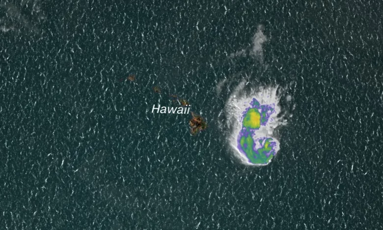
Packing winds of 60 mph, Calvin was about 175 miles southeast of Hilo, according to a Tuesday evening update from the National Hurricane Center.
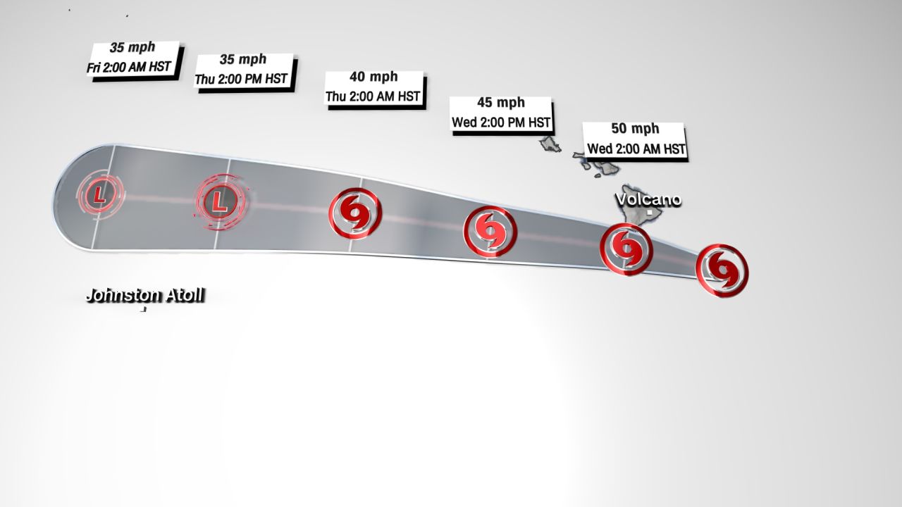
The storm threatens to deliver strong winds and heavy rainfall that could result in flash flooding and mudslides. Calvin is expected to remain a tropical storm for a day and a half before weakening later this week.
“Calvin is forecast to pass south of Hawaii County tonight, bringing a period of flash flooding, dangerous surf and damaging winds. Calvin is expected to weaken as it moves westward to the south of the other Hawaiian Islands Wednesday and Wednesday night,” the National Weather Service in Honolulu said.
Between 4 and 8 inches of rain are expected, with some areas seeing up to 10 inches, mainly along the windward and southeast flank of the island of Hawaii, colloquially known as the Big Island.
Rainfall of 3 to 6 inches are expected on the windward areas of Maui, and 2 to 4 inches of rain could fall elsewhere in the state.
Hawaii Gov. Josh Green declared a state of emergency Tuesday for the Big Island, where government offices are expected to close Wednesday.
“Non-essential employees affected by the closing of those offices should not report to work and shall be granted Administrative Leave,” the governor’s office said.
Later tonight, swells generated by Calvin are forecast to begin spreading across the main Hawaiian islands, leading to a rapid increase in surf along east-facing shores into Wednesday. This elevated surf will likely cause life-threatening conditions along exposed shorelines.
CNN’s Andy Rose contributed to this report.

