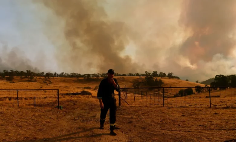
Flames burned through 46 million acres from June 2019 to January 2020 – during Australia’s summer months – thrusting emissions into the Earth’s atmosphere and potentially shifting weather patterns, said a study published in Science Advances on Wednesday.
The study, led by the National Center for Atmospheric Research (NCAR), said the disaster was “exceptional in both its severity and particulate emissions,” releasing smoke levels similar to a major volcanic eruption.
Scientists John Fasullo, Nan Rosenbloom and Rebecca Buchholz from NCAR in the United States used new modeling to demonstrate how emissions from the bushfires may have shifted weather patterns.
Their research suggests smoke emissions led to the formation of clouds over the southeastern Pacific Ocean, which absorbed radiation from the sun and cooled surface water temperatures.
These disruptions may have helped trigger the rare three-year La Niña event, that brings wetter and cooler conditions to the Pacific Northwest and Northern Plains of the US, especially during the winter, and drier and warmer conditions in the south.
The recent La Niña event stretched from late 2020 to early 2023 – an unusually long period that created a series of devastating tropical cyclones and intense hurricanes in some places and exacerbated drought in others.
Australia was also dragged to extremes, suffering historic rainfall and floods over that period.
“Many people quickly forgot about the Australian fires, especially as the COVID pandemic exploded, but the Earth system has a long memory, and the impacts of the fires lingered for years,” said NCAR scientist Fasullo, lead author of the study.
How did wildfire emissions set off La Niña?
Scientists have previously established that large volcanic eruptions in the Southern Hemisphere can shift the odds toward the formation of La Niña. In such instances, smoke high in the atmosphere results in the formation of light-reflecting particles called aerosols, which can cool the climate and ultimately create favorable conditions for La Niña.
This time researchers found that smoke aerosols from the unprecedented Australia wildfire season had brightened cloud decks, especially off the coast of Peru, which cooled and dried the air in the region. That ultimately shifted the zone where the northern and southern trade winds come together, cooling the Pacific Ocean and creating the perfect conditions for the La Niña formation.
Although the emissions from the fires lingered in the atmosphere for several months, it triggered an even longer feedback loop that created successive La Niña weather patterns for years.
“The results here suggest a potential connection between this emergence of cool conditions in the eastern Pacific Ocean and the climate response to the Australian wildfire emissions,” the paper stated.
Australian climate scientist Tom Mortlock, who was not involved in the study, said the research was “the first time a bushfire event has been widespread enough to have an impact in climate models,” and highlighted the “interconnectivity of the climate system.”
The recent La Niña streak is also unusual because it is the only one that did not follow a strong El Niño – the opposite pattern of warming instead of cooling in the Tropical Pacific.
This year, weather agencies are forecasting a more severe El Niño, exacerbated by warming global temperatures, which may bring impacts like extreme heat, dangerous tropical cyclones and a significant threat to fragile coral reefs.


